File:Empire-map.jpg
Jump to navigation
Jump to search
Size of this preview: 800 × 401 pixels. Other resolution: 3,761 × 1,885 pixels.
Original file (3,761 × 1,885 pixels, file size: 13.98 MB, MIME type: image/jpeg)
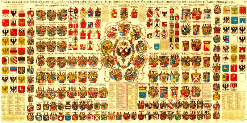
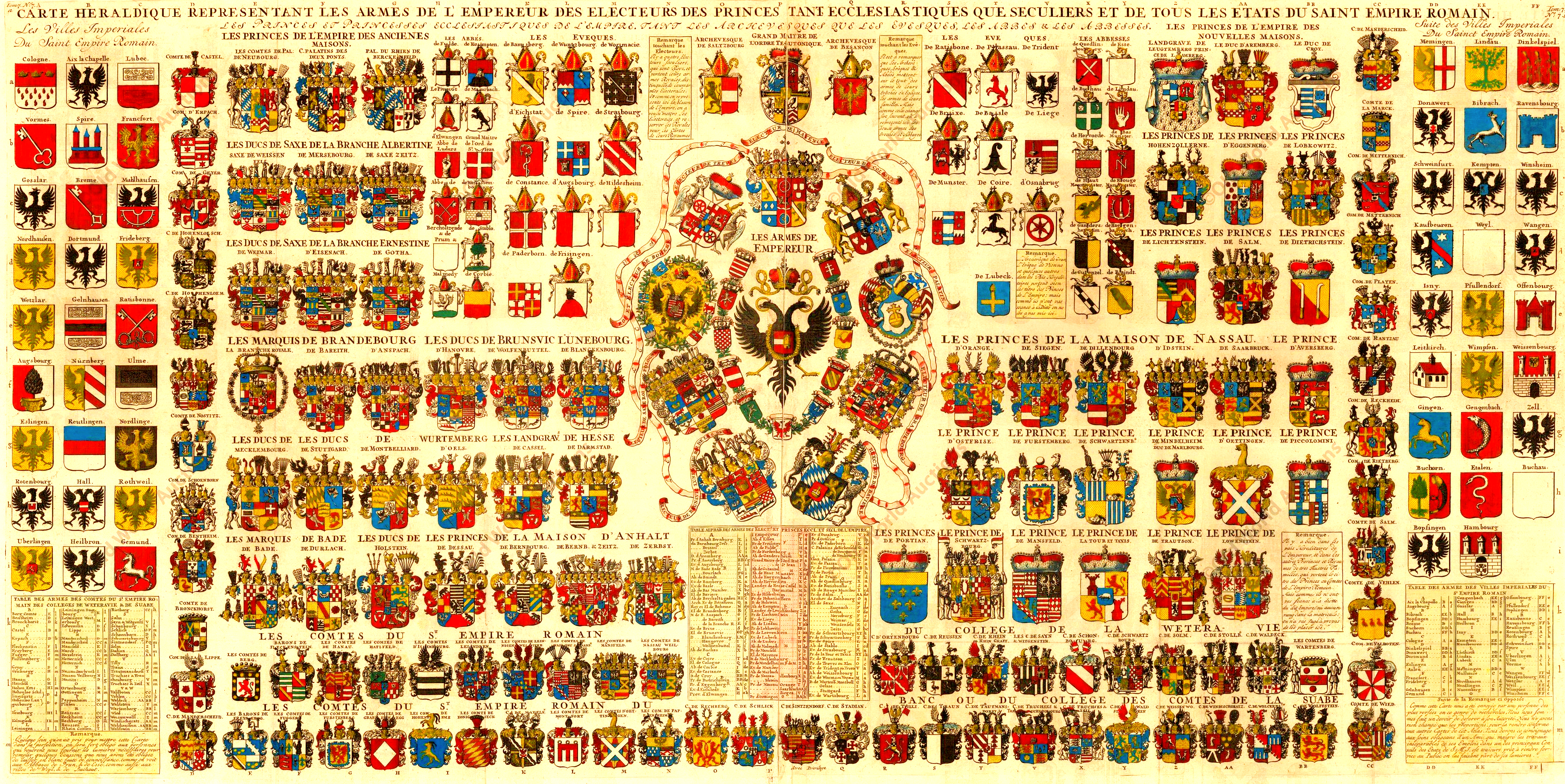
Large file with the arms of (most) territories in the Holy Roman Empire. French map from 1719 by Henri Abraham Châtelain (1684-1743) Original size: 49.5 x 98 cm. (image taken from post on Reddit, but from some auction site (?))
File history
Click on a date/time to view the file as it appeared at that time.
| Date/Time | Thumbnail | Dimensions | User | Comment | |
|---|---|---|---|---|---|
| current | 15:15, 2 January 2022 | | 3,761 × 1,885 (13.98 MB) | Knorrepoes (talk | contribs) |
You cannot overwrite this file.
File usage
The following page uses this file: